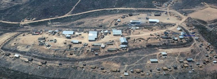
Layout of A-109
Thuong Duc A-109
Aerial view of A-109
Special Forces camp A-109 was a typical SF camp. It consisted of an American compound surrounded by an outer band
occupied by the CIDG troops. The outer area also contained the Vietnamese 'District government' headquarters. To the south (and slightly
west) was a CIDG outpost. The outpost and camp A-109 straddled 'fingers' -- ridges that extended down from the high plateau to the
river valley. As such the camp had a commanding view of the river and the river valley.
Unfortunately, I did not have the foresight to
make a panoramic view of Thuong Duc and the surrounding area. By that I mean that I did not stand in one spot and take a series of
pictures spanning the entire 360 degrees. The pictures presented below show some views from inside the American compound. Some of the adjacent,
surrounding terrain (in the general direction indicated) is also visible. Let's start with the view looking east. As you saw on the location
page, fingers from the north and south plateaus framed the eastern view -- providing a dramatic 'doorway' effect. Indeed, A-109 at Thuong Duc was an important
gateway ('doorway') to the coastal plain and Danang.
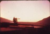
Sunrise at Thuong Duc
Sunrise at A-109 was breath-taking! The ridges extending down from the plateau to the river valley formed a truncated "V" which framed the sun
as it crested the horizon.
The .50-cal machine gun position is silhouetted by the rising sun.
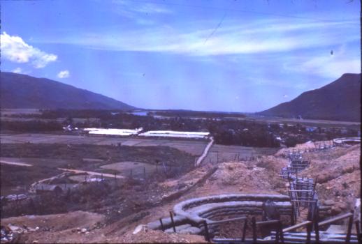
Looking east
The ridges extending down from the north and south plateaus are more easily seen in this eastward view. Twnety miles away lies the South China Sea.
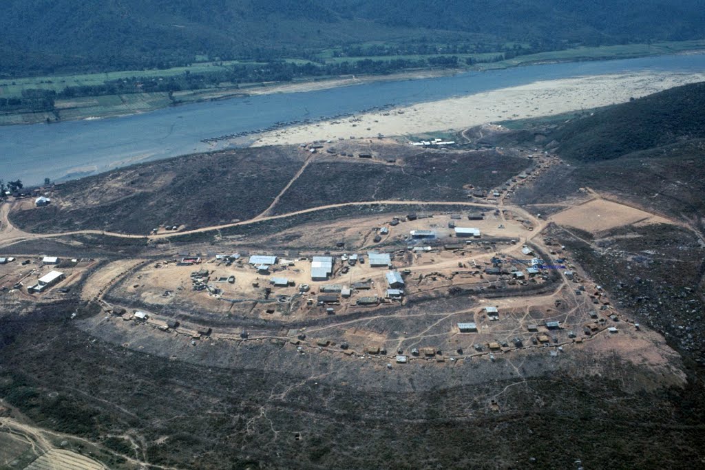
Position relative to river and outpost
This view encompasses a larger field of view than the image at the top. The picture illustrates how the camp was built on an elevated area --
one of the 'fingers' that extended from the river valley to the plateau. The CIDG 'outpost' lies directly above the camp in the image.
The village of Thuong Duc was accessed using the road from the right side of the picture (wrapping sharply to the left) and descending down to the
river and the village. A dirt path branches off of this road and served as access route up to the outpost.
I found this video on YouTube years ago. It seems to be a view of Thuong Duc (as seen using Google Earth) with background music. It provides a reasonable perspective of the terrain surrounding the village of Thuong Duc. I looked for this video in late 2016 and could not find it. I do not know who created the video, nor do I know the English translation of the lyrics.