Taking your gun for a walk
"...going to the boonies!"On patrol... dedicated to all who spent time 'in the boonies'
Going on patrol was always scary
However humble our camps were, the comfort and safety was far greater than on patrol. Patrols usually left about 3AM... obviously under the cover of darkness. It amazed me that the Vietnamese always seemed to be able to see, regardless of how little light there was. There were times when I would actually grab hold of one of the Vietnamese and motion for him to go. I just couldn't see! Had we ever been ambushed under those conditions, I for one would have been defenseless.
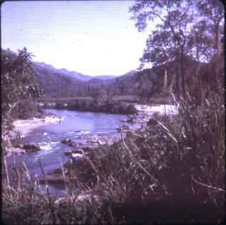
The 'low' ground
Out the camp gate we go in single file. (The next four to eight days would literally be spent in single file.) By the time dawn arrived, we
were generally three miles from camp. The terrain was fairly benign close to camp. We were still in the river plain and the surrounding
ground had been hacked into submission by generations of farmers. No thick jungle here.
Viet Nam was/is a beautiful country. The scene on the left is typical of the stream/river beds and the flat areas adjoining them. It is more
likely to bring back memories of trips to our state parks. A picture such as this gives no advance warning of the difficult terrain which lies
ahead.
However, if you take time to actually look at the photo, you will note the mountains in the center of the photo. Notice how quickly the
elevation rises. While out humping the boonies, I used to think that all of Viet Nam was either flat... or vertical.
Another hidden danger, even though Viet Nam was not truly an industrial country, was the water quality. Before America became an industrial
power, you could drink directly from many of the streams and rivers. Although not contaminated by industrial wastes, many of the water sources
were not potable to Americans. Animal waste and other substances made the water undrinkable to American soldiers.
Soon, though, we would begin to climb the mountains and into the jungle. The ground was covered by thick vegetation and -- overhead -- the
sky was hidden by a thick canopy of tree branches and leaves. There were some trails or paths through the jungle, but these avenues were
to be avoided. Paths/trails were the meccas for ambushes. Trails were sometimes 'booby-trapped'. Lt. Carter and I found at least one path
rigged with a Malayan swing gate and one with a pit (camouflaged with branches) that was filled with [punji] stakes.
It seemed that the jungle was always wet and the ground, slippery. Lt. Carter and I would keep ourselves entertained by counting how many the
other guy would slip and fall right on their face. There seemed to be vines everywhere -- reaching out as if to say "Wait a minute!".
The vines would snag something -- your M-16, boot, rutsack, something! Coupled with the wet ground it meant a sure ticket to a faceprint in
the mud.
Time, like the patrol, often moved at a snail's pace. The jungle was so thick - the terrain so rough - that it often took eight hours to go
less than a mile. Unlike the John Wayne movie (The Green Berets) where the men went running through 'the jungle', there was no running here!
The Lt. and I several times followed stream beds -- actually in the water. First of all, you left fewer tracks of your passage in the stream
and secondly the vegetation did not grow in the stream. However, this was slippery, treacherous going, since the stream beds were usually
very steep terrain.
It has been thirty-some years, so I guess it is safe to talk about "gravel". The US had an experimental weapon called
"gravel". It consisted of a high explosive that looked like rocky river or stream ground; it was intended to blend in with the
actual stream or river bed. It was dropped from the air, like a 'seeding' operation. When it struck the ground, it became 'armed'. Stepping
on it anytime during the next twenty-four hours would detonate the explosive. After that time the material was harmless. This weapon was
intended to take this avenue of travel (that is, the stream beds) away from the VC.
One day the Lt. stopped the patrol for lunch. We were on a trail. It was probably around noon. The pictures below were taken during that break.
I want to emphasize -- this was 'high noon' in the jungle! Notice how difficult it is to see. An individual wearing camouflage could easily sit
three feet off of this path and never be seen -- the patrol would walk right by him. If his intent were to shoot you, you would never know
where the bullet came from.
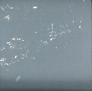
In the dark of the day...
This was my first attempt to take a picture in the jungle. While amid the thick vegetation and under the canopy, the scene was a composite of
sharp contrasts. When the sun did make it through, it was very bright... almost blindingly bright. Immediately adjacent to these bright areas
were areas that were in extremely dark shadows.
As far as this picture goes, I made the mistake of standing in a lighted area to take this picture. It 'washed out' the photo, losing much of
the detail and contrast. However, it illustrates the effect on your eyes.
The wide brim on the floppy hat shielded your eyes from these bursts of brilliant sunlight. The shade from the brim allowed your eyes to
transition, greatly aiding your ability to see.
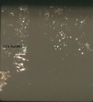
'High noon' in the jungle
For this picture I stood in a shaded area... out of the direct sunlight. Notice the sharp definition -- the high contrast.
Lt. Carter is squatting on the trail... almost exactly centered in the photo. He is facing perpendicular to the trail, looking to my left.
The only part of him you can really see are his hands. (I have marked the picture, right above his hands.)
Again, notice the thickness of the vegetation further past Lt. Carter.
While you were stopped, you were the target of the leeches. They were everywhere in the jungle. They would drop off the trees or crawl to you on
the ground. Looking like a tapered cylinder they would 'sit upright' on their wide end and swivel left-right-left. The heat sensors in their body
could zero in on your exact location from several feet away. For them, it meant lunch was also served. You!
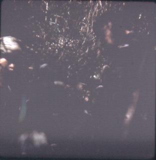
Ambushes were easy -- survival was tough!
This photo is from another rest break we took. (I was concerned that my other pictures did not turn out because it was so dark.)
Lt. Carter is on the right third of the photo and one of the Vietnamese is on the left third of the picture.
Does the statement 'three feet off the trail and motionless meant you were invisible' have more meaning now?!? This is how and why we
(and the VC) were able to pull off such effective and deadly ambushes.
The Vietnamese fellow may have been asking for C-4 plastic explosive. We used it to heat food because, when lit with a match or cigarette lighter,
it burned like a solid 'Sterno'. However, that same C-4, when subjected to a sharp shock such as a blasting cap, would detonate! We couldn't trust
the Vietnamese to use it for cooking. They could burn half and save half for use against you later.
Our mission on this patrol was to survey the type and quantity of traffic on the road to Kontum. Using topographical maps the Lt. would fix
our current position and then provide a new bearing/direction to the "patrol leader" -- we were just advisors. As the patrol progressed, we
adjusted our course. After assessing our position Lt. Carter showed the patrol leader where we were and the direction we needed to go.
(Remember: We had no interpreter.) After traveling for some time, we re-assessed our position and noted that we were not going in the direction
necessary to intersect the Kontum road. Again, Lt. Carter pointed out current position and our target/destination. We indicated the direction
the patrol needed to take. After some animated affirmative head-shaking, the patrol leader set out.
After another couple hours it was time to see just where we were. A check of the 'topo' maps clearly showed that we were not going in the correct
direction. This time we tried a kick in the a** and a shove in the correct direction on the patrol leader. After an hour or so we stopped on the
side of a mountain to assess our position. We soon realized that we were directly across from the Kontum Road. The Lt. pointed this out to the
patrol leader. We could see the road on the opposite hillside. Pointing to the road, the Lt. said "[Dee dee!]" which meant "Go!" The patrol
leader shook his head; "No" -- "[Beau coup] VC" is all he would say. We never did make it to the Kontum Road. As the picture below illustrates,
we got close!
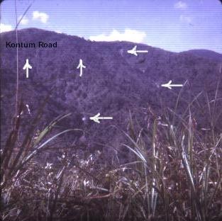
Kontum Road
The two arrows pointing UP mark the road to Kontum. It is visible as a faint horizontal line on the side of the mountain. (The road is carved
out of the side of the mountain, creating the 'line effect'.) This road was a major route to the south and west from Da Nang and the coastal
areas.
The three LEFT-pointing arrows mark visible waterfalls. Perhaps you can get a sense of how rugged the terrain was. The area directly above
the left-most waterfall was almost vertical. Even though using streams to cover your patrol's tracks was good military tactics, maybe you can
get a feel for how difficult it was to travel in the water.
This was as close as our patrol would get to the Kontum Road. The patrol leader refused to get close to the road so that we could monitor traffic.
Maybe that wasn't such a bad idea after all.
Did you notice how the vegetation changed from jungle to elephant grass? See how tall it is? -- and this was after we stomped on it a while.
In order to get 'a fix' on our position, we had to find some high ground with elephant grass. We would trample the grass enough to see the
topography of the surrounding area. We would match up what we saw around us with the features on the map.
Heading back to camp...
We tried not to use the same route returning to camp that we used to leave camp. Too dangerous! One morning on the way back we broke camp early -- very early! Why? We had to cross the river. River crossings were extremely dangerous! The Vietnamese were so physically small that they had to hold onto each other to get across the river. (Otherwise, the current would wash them away.) But the Americans were not supposed to do that. Imagine: the two prime targets of the patrol, side by side! Once you were in waist- to chest-high water, there was no running. If you were ambushed while in the water, you were in DEEP sh**! The river rocks were slippery and often you lost your balance. Everything you had was then wet. Even one of your most cherished possessions, dry socks, then failed to exist. It was miserable.So on this particular morning we set out to cross the river. It was barely light enough to see. Two by two the Vietnamese started across the river.
Then the Lt.
More Vietnamese.
I was toward the end of the patrol. I snapped the picture below. It was a scary time.
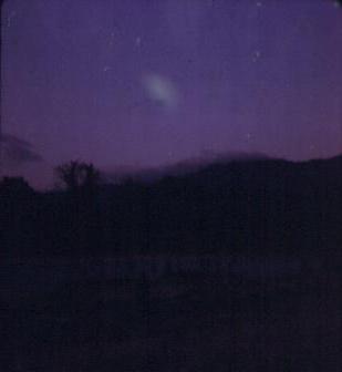
The 'pucker factor'....
This is a scanned copy of my original slide. This picture accurately represents the conditions when we
crossed the river very early in the morning. There is nothing wrong with your monitor.
If you are lucky, you can discern some shadowy figures approximately one-third up from the bottom. Because of concerns about noise discipline,
you couldn't shout or yell -- even if you got into trouble crossing the river. That could result in giving away the patrol's position. The
Americans had to ford the river by themselves. I don't mind telling you that this was one part of a patrol that scared the crap outa me.
The picture below is this same picture, but I tricked my scanner into making it lighter. For a better view of the river crossing, see below.
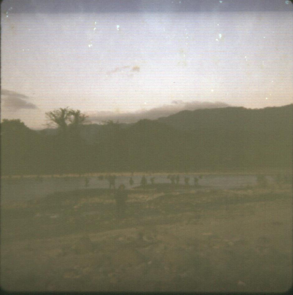
In this enhanced photo you can see how vulnerable you are when doing a river crossing. If you were ambushed, it would be almost impossible to
bring the patrol's firepower to bear on the enemy position... because your patrol was strung out over a large area.
Were you nervous, Virgil??
It took up to a couple hours to get across the river and get the patrol re-assembled. When the river was high, some of the Vietnamese could be
washed as much as a kilometer downstream. I don't recall ever losing any Vietnamese to drowning, but I know there were times we came close.
Eventually, the patrol would get nearer to camp and the terrain would be easier to traverse. As the picture (below) shows, it sometimes
seemed like you were out "taking a hike". Except here you could easily be killed.
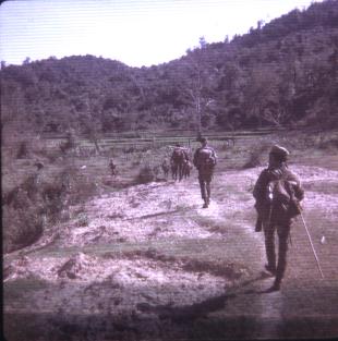
In this picture you can see Lt. Carter directly ahead of the nearest Vietnamese fighter. The CIDG often used a 'hiking stick' when on patrol.
This area was relatively close to camp and was considered a 'safe area'. Soon we would be back at camp... able to enjoy dry socks, warm beer,
and a generator.
Just above Lt. Carter's head (in the background) you can see some rice paddies. But notice once again how quickly the thick vegetation begins
and the terrain gets quite steep at the far edges of the rice paddies.
I think we were out for six days on this patrol. Did we accomplish our objectives? Not all of them. But it wasn't because we didn't try!
So, Lt. Virgil Carter: Does this bring back some memories??
